


Filed under: Uncategorized | Leave a comment »
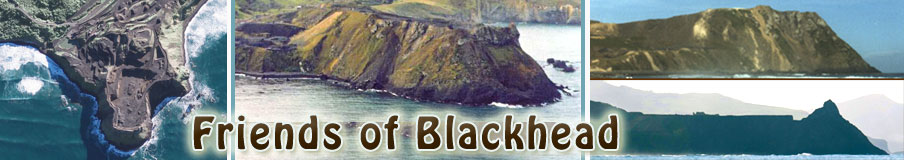
Blackhead Headland a volcanic outcrop has been mined for its rock for road construction since the 1930’s, once a rounded picturesque headland, its has now lost more than half its volume. A covenant placed upon it in 1991 protects the end of the headland and the rare rock formations of the Roman Baths and Docks.. similar in structure and value as the Giants Causeway in Ireland. here is a flyover of the headland in February 2012 along with footage from the land. Filmed by Nic Reeves of phoam.co.nz.
<p><a href=”http://vimeo.com/38206958″>Blackhead Quarrying February 2012</a> from <a href=”http://vimeo.com/user376158″>Nic Reeves</a> on <a href=”http://vimeo.com”>Vimeo</a>.</p>Filed under: Uncategorized | Leave a comment »
 Here a photograph taken around the turn of the 19th century of the Blackhead headland from tunnel beach area on the north east side has been overlayed by a photo taken in 2011 of the lowered profile of the headland due to quarrying activities.
Filed under: Uncategorized | Leave a comment »

Filed under: Uncategorized | 1 Comment »

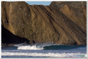
Blackhead quarrying update, I’ve been taking progress photos for months, but not posted. The main sequence above is 15months of quarrying and lowering on the south side of the quarry which is the face that is seen from Blackhead Road and the carparks. Heaps of activity and changes, the one big thing is the disappearance of what I call ‘the slip’ which was clay slide shaped like an arch.

Filed under: Uncategorized | Leave a comment »

Almost every day I drive past the Blackhead headland and Quarry. Every time constant quarrying activity has moved more gravel piles, eaten away at the rock faces and the profile has been nibbled away like a slow methodical attack on a girl guide biscuit.

Last month a refreshing walk along Blackhead beach revealed more than a pretty reflection.


Filed under: Uncategorized | Leave a comment »

The above image was taken at the end of January, since then the rock splitter has been chipping more away. Below, a comparison from a similar view from brighton beach with 5 and a half years between the two shots, the lower image showing a red line of the previous level.
Filed under: Uncategorized | Leave a comment »


Filed under: Uncategorized | Leave a comment »


Filed under: Uncategorized | Leave a comment »

| Vic on 2 years of quarrying on the da… |


